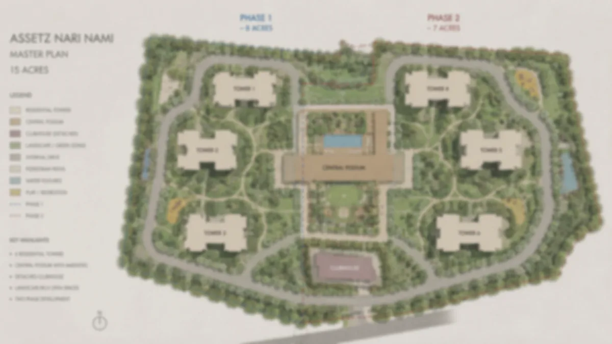
What Is Known About the Master Plan, and What Is Derived
| Element | Position on this site | Register |
|---|---|---|
| Land area | 15 acres (653,400 sqft) | Circulating as a 15-18 acre range; we publish the low end |
| Homes | 725 apartments | Circulating as 700-750; we publish the midpoint |
| Towers | 6 residential towers | Derived. No source gives a tower count at all |
| Floors | 2B + G + 30 upper floors | Derived from the homes-per-plate arithmetic |
| Homes per floor-plate | ~4 per core | Derived |
| Open space | "75%+" | Circulating, and it survives a footprint check |
| Podium | Vehicle-free central podium | Circulating |
| Clubhouse | Standalone, with rooftop pool, wellness deck and co-working pods | Circulating. No area figure is published here |
| Saleable area | ~1.21 million sqft | Derived from the mix and sizes |
| Building height in metres | Not published | No source supports one and none is honestly derivable |
| Planning authority | Bangalore Development Authority (BDA) | Unconfirmed — competence to sanction, not a sanction |
Land Use and the Density Arithmetic, at the Scale in Circulation
Fifteen acres is 653,400 sqft. Carrying 725 homes on it gives 48.3 homes per acre — roughly half the corridor norm for high-rise, which runs from 72 per acre at Sobha One World up to 163 at Brigade Belvedere, with Godrej Parkshire at 81, Godrej Woodscapes at 85, Brigade Calista at 90, Brigade Citrine at 98 and Sattva Songbird at 108 in between. The only comparably low-density scheme on this road is Assetz Bloom & Dell at 51.2 per acre, and that is a large-format product built around a 1,839 to 2,039 sqft three-bedroom plate. Our sources disagree on whether it carries any other configuration — the developer's catalogue, its Karnataka RERA record and a listing portal each describe the mix differently — so this site does not call it a three-bedroom-only scheme.
That single number drives everything else in the plan. At half the corridor's density, the towers can be spaced rather than packed, the plates can be small, and the ground plane has room left over. It also means the plan and the entry price in circulation are pulling against each other, which is covered in full on the overview page and is worth holding in mind while reading this one.
An indicative land-use split at this density — derived, not published — looks like this:
| Element | Indicative allocation | Share |
|---|---|---|
| Total site | 15 acres | 100% |
| Tower footprints at ground | ~1.7-2.1 acres | ~11-14% |
| Clubhouse, amenity and sports precinct | ~1.0-1.3 acres | ~7-9% |
| Arrival court, internal roads, ramps and fire access | ~1.5-2.0 acres | ~10-13% |
| Setbacks, buffers, utilities, STP and services | ~1.0-1.3 acres | ~7-9% |
| Landscape, greens and open ground plane | ~8.5-9.5 acres | ~57-63% |
Read that table as a shape rather than as a specification. What it establishes is that at 48 homes per acre, a genuinely generous open ground plane is arithmetically available — which is not true of most schemes on this corridor.
The Tower and Floor Count: How This Site Derives It
This is the most invented-looking figure on the site, so here is the whole derivation.
Nothing in circulation gives a tower count. Start from the two figures that are circulating — 725 homes on 15 acres — and one verified corridor constraint, which is the floor band. Registered and marketed projects on this side of the city run from G+24 on a fourteen-tower Kadugodi scheme, through G+29 on an Assetz registration in north Bengaluru and G+36 on Assetz's other East Bengaluru pre-launch, up to G+43 at Budigere Cross. G+30 sits inside that band but in its lower half — the midpoint of G+24 to G+43 is a little over G+33, so a thirty-storey stack is a shorter tower than the corridor's median, not a taller one. That is the conservative end to derive from, which is the point.
Then:
- 725 homes ÷ 6 towers = 121 homes per tower
- 121 homes ÷ 30 upper floors = 4.03 homes per floor
Four homes per core is exactly the plate a low-density, large-format product implies. Run the same arithmetic with more towers and the plate shrinks below four, which is a luxury-format signature this price band does not support; run it with fewer and the plate climbs past six, which contradicts the density. Six towers at G+30 is the configuration where the three constraints — homes, land and floor band — agree.
Two basement levels are assumed with the parking arithmetic below, hence 2B+G+30.
On height in metres: we publish none. A floor count can be derived from a plate; a height in metres cannot, because it depends on floor-to-floor dimensions, podium and transfer-slab depths and terrace treatment that no source discloses. Any height figure you see quoted for this project has been made up, including any that might be back-computed from our own floor count. Ask for the sanctioned elevation drawings instead.
The Floor-Plate, and Why the Homes-per-Core Number Matters
The floor-plate is the most consequential number in any tall-building master plan, and it is the one buyers ask about last.
At roughly four homes per floor across a 30-storey stack, this scheme would sit at about half the plate density of a typical Bengaluru high-rise, where eight to twelve homes per core is normal. What that buys, if it holds:
Lift performance. At 30 floors, peak-hour lift waiting is the single most-cited daily frustration in tall residential buildings. Fewer homes per core means fewer calls per lift, and short of adding lift cars it is the only real lever on the problem. Ask how many lifts serve each core and what the design waiting interval is — both are in the services drawings.
Two exposed faces for most homes. On a four-unit plate, nearly every apartment is a corner unit. That means cross-ventilation, daylight from two directions and one fewer shared wall. In Bengaluru's climate, cross-ventilation on a north-south plate does more for year-round comfort than any mechanical system a brochure will list.
Less corridor loaded into your price. Common corridor area is distributed into every apartment's super built-up figure. A tighter plate carries less corridor per home, which is one of the reasons the carpet-to-super-built-up ratio matters more than the headline size. On Assetz's own registered project on this road that ratio runs about 68%.
Fewer neighbours per lobby. Four households sharing a lift lobby is a materially different daily experience from twelve, and it shows up in maintenance behaviour and in resale.
All four are consequences of a derived figure. Get the units-per-floor number for your specific tower from the sanctioned plan before you treat any of them as bought.
The FAR Check: Saleable Area Against the Land It Sits On
At the derived sizes and mix — 180 two-bedroom homes at 1,200 sqft, 400 three-bedroom at 1,650 and 145 four-bedroom at 2,300 — the weighted average is 1,668 sqft super built-up, and the scheme carries roughly 1.21 million sqft of saleable area.
On 653,400 sqft of land, that is a saleable-area ratio of 1.85, or about 1.48 on built-up area once a 25% loading is stripped out. Every sanction envelope available on a parcel of this size and road class sits well above that.
The conclusion is worth stating plainly, because it cuts both ways. A scheme this far under its permissible envelope is the arithmetic fingerprint of a genuine low-density product — a developer choosing to build less than the land allows, which is what produces spacing, plate quality and open ground. It is also the reason the low entry price circulating ahead of launch does not reconcile: unbuilt permissible area is expensive, and somebody pays for it in the per-sqft rate.
If a sanctioned plan eventually shows a materially higher built area on the same land, then either the unit count or the unit sizes in circulation are wrong — and the density story on this page goes with them.
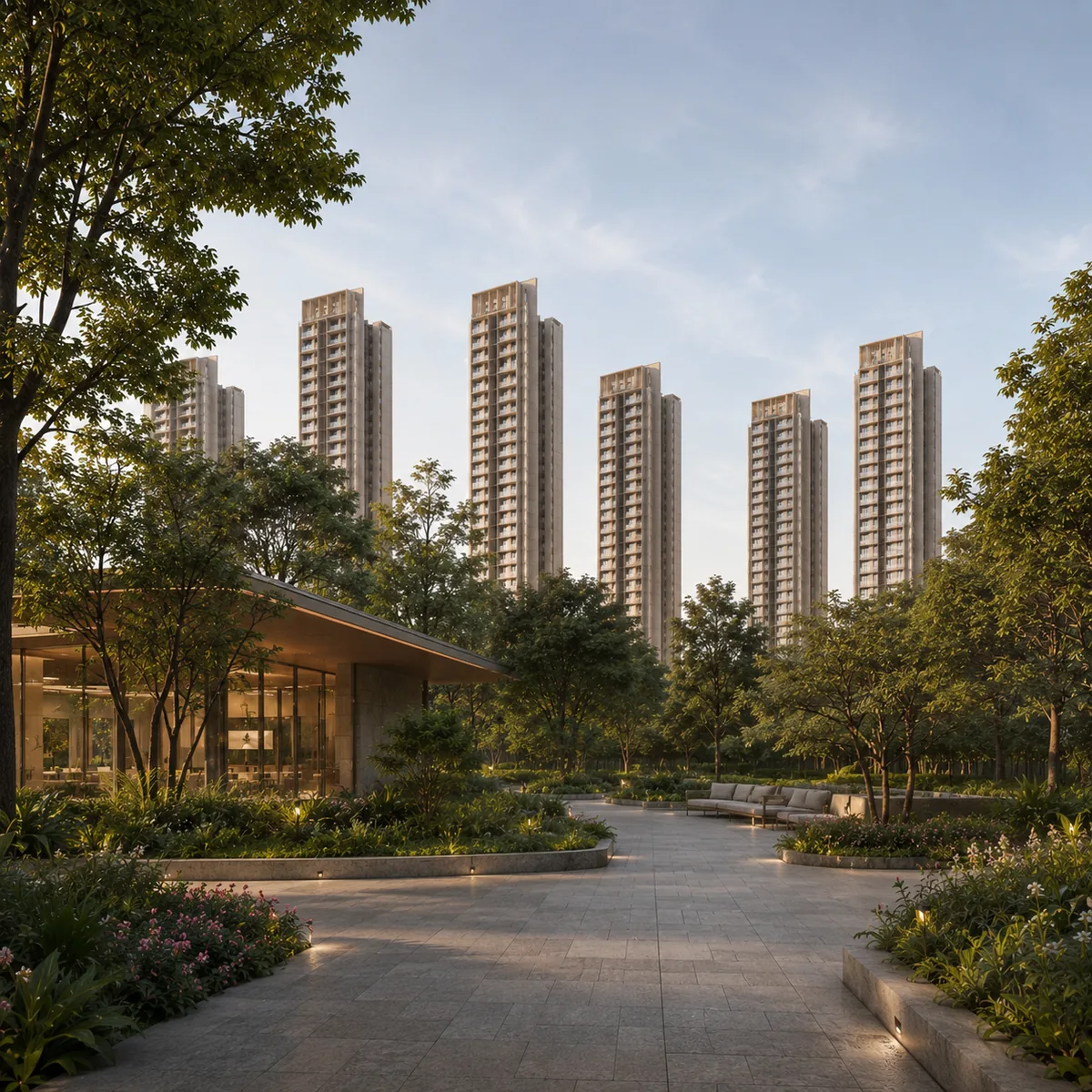
The Vehicle-Free Podium, the Basements and Parking
A 100% vehicle-free central podium is one of the specific claims in the material circulating ahead of launch. It is also the claim with the most arithmetic behind it, so it can be tested.
Take a parking provision appropriate to a 2/3/4 BHK mix skewed toward three and four bedrooms: one covered bay per two-bedroom home, two for each three- and four-bedroom home, plus visitor parking at around 10%. That gives (180 × 1) + (400 × 2) + (145 × 2) = 1,270 resident bays and roughly 1,400 bays in total.
At 320-350 sqft per bay including aisles, ramps, columns and circulation — the working range for basement parking — 1,400 bays need 450,000 to 490,000 sqft of basement. Across two levels that is 225,000 to 245,000 sqft per level, or roughly 5.1 to 5.6 acres of basement footprint, which is 34-37% of the site.
Two consequences follow, and both are useful to a buyer:
- Two basements are workable at this scale, but only just, and only if the basement extends well beyond the tower footprints. If the sanctioned provision turns out closer to 1.5 bays per home, the requirement drops to about 1,200 bays and 400,000 sqft, which fits two levels comfortably. Ask what the sanctioned bay count is and how many bays come with your specific configuration.
- Most of the "open space" would sit on a podium deck, not on natural ground. A basement covering a third of the site, decked over and landscaped, is how a vehicle-free ground plane is achieved — and planting on a slab is governed by soil depth. Lawns, shrubs and small ornamental trees are straightforward; mature canopy trees need either natural ground or a deliberately deepened planter zone. If native tree lines matter to you, ask which parts of the landscape sit on soil and which sit on structure. It is a one-line answer from the landscape drawings and it changes what the grounds will look like in fifteen years.
Circulation: Arrival, Fire Access, Service and the Pedestrian Layer
With parking taken below ground, the ground-plane circulation plan simplifies to four systems.
Vehicular. A gated arrival court off the site frontage, feeding a distribution loop that serves the basement ramps and each tower's drop-off. On a 15-acre parcel there is room to hold that loop to the perimeter and the tower approaches rather than driving it through the middle of the site.
Fire tender access. A 30-storey building requires appliance access to every tower, and that requirement governs road widths, turning radii and the structural loading of any slab a tender must cross — including podium decks. It is the reason a vehicular loop cannot be designed out entirely, and it is the constraint that most often reshapes an otherwise car-free ground plan. Ask to see the fire-tender path marked on the layout.
Service. Waste collection, deliveries, maintenance and goods movement should run on a separate route with their own access, so that service traffic never crosses the resident pedestrian network. On a scheme with 725 households this is a daily-quality issue, not a detail.
Pedestrian. If the podium claim holds, the interior of the site becomes a continuous walking layer — loops, gardens, amenity approaches — traversable end to end without crossing a road. In a community of this size, with the child and senior population it implies, that separation is the most consequential safety outcome in the whole plan.
The Clubhouse, and Why No Area Figure Appears Here
The material in circulation describes a standalone signature clubhouse with a rooftop swimming pool, an open-air wellness and yoga deck and digital co-working pods. Standalone matters: a clubhouse in its own building, rather than wrapped into a tower podium, is easier to run at hours that do not disturb residents and easier to expand later.
No clubhouse area is published on this site, and that is deliberate. Clubhouse square footage is the specification most often inflated in pre-launch marketing and most often disagreed on between sources. One Assetz pre-launch elsewhere in East Bengaluru has had its clubhouse quoted at three materially different areas across the pages that market it — a spread of nearly two to one on the same building. Publishing a number in that environment would be guessing with a decimal point on it.
What to ask for instead, in this order: the sanctioned amenity area in the approved plan; whether it is measured as built-up or as usable floor area; whether the rooftop pool is on the clubhouse or on a tower, because that changes access rules and maintenance liability; and which facilities are in Phase 1 rather than promised for a later phase. On a phased scheme, an amenity delivered with the last tower is an amenity you pay for years before you use.
Open Space and the 75% Claim, Tested
The claim in circulation is 75%-plus open space with native tree lines and micro-climate landscaping. Unusually for the claims around this project, it survives an arithmetic check.
A quarter of 15 acres is 3.75 acres, or 163,350 sqft, available for everything that occupies ground: tower footprints, the clubhouse, driveways, arrival court and basement ramps. Six tower plates at 12,000-15,000 sqft each consume 72,000 to 90,000 sqft of that. That leaves 73,000 to 91,000 sqft for a standalone clubhouse, the arrival sequence, the ramps and the roads — enough, without strain.
So the 75% figure is internally consistent with a six-tower, 725-home scheme on 15 acres. It is the one circulating claim about this project that passes its own test, which is worth saying precisely because so few of the others do.
Two qualifications travel with it. First, as set out above, a large share of that open plane would sit over basement structure, and podium landscape is not the same thing as ground. Second, "open space" in Indian residential marketing is not a defined term — it can include setbacks, driveways, the space between towers and the roof of the clubhouse. The defined term is the one in the sanctioned plan. Ask for that figure and how it is measured.
The Plant Behind a Community This Size: Water, STP, Rainwater and Power
The infrastructure a master plan carries is invisible in a brochure and decisive in occupation. None of it has been published for this project, so what follows is derived from standard design norms and the scheme's own scale. Every figure is an estimate, and every one of them can be redone with the sanctioned drawings once they exist.
Water demand. At 725 homes and roughly 3.5 residents per home, the scheme houses about 2,540 people. At the 135 litres per capita per day norm commonly applied in Indian residential design, domestic demand runs to about 343,000 litres a day — roughly 0.34 MLD — before landscape irrigation and common-area use.
The source of that water is the question this belt has to answer honestly. This stretch of the Whitefield-Hoskote Road sits in Bidarahalli Hobli, outside any city corporation; the Bengaluru East City Corporation boundary begins further south, around Belathur and Kadugodi. Nothing in the public record establishes a piped municipal connection to this belt. In practice that means borewells, tanker supply and recycled water carry the load, and it makes three questions load-bearing at the enquiry stage: what is the sanctioned water source, how many borewells at what yield, and what is the standby storage in days.
Sewage treatment. An STP is normally sized at 80-85% of water supply, which puts this scheme in the 275-300 KLD range with a design margin taking it to a 350-400 KLD class plant. Treated water is what irrigates the landscape and flushes the toilets in a scheme of this type, so its capacity is directly connected to whether the 75% open space can actually be kept green through a Bengaluru summer. Ask for the plant's rated capacity, its technology, and where the treated-water dual plumbing runs.
Rainwater harvesting. Fifteen acres is about 60,700 square metres. Against a Bengaluru long-period average of roughly 970 mm of annual rainfall and a composite runoff coefficient of about 0.6 across roofs, paved surfaces and landscape, the site would shed on the order of 35 million litres a year. Set that against the 0.34 MLD domestic demand and it is equivalent to about 100 days of full supply — not self-sufficiency, but a material share, and the difference between a scheme that buys tankers through March to May and one that does not. What determines whether any of it is realised is recharge and storage capacity, so ask for the number and volume of recharge wells and the size of the harvesting sump.
Power. At an average sanctioned load of about 5 kW per home, 725 homes represent roughly 3.6 MW of connected load. Applying a diversity factor in the 0.35-0.45 range gives 1.3-1.6 MVA of residential maximum demand, and common-area load — lifts, pumps, the STP, lighting, the clubhouse and electric-vehicle charging — typically adds another 0.4-0.6 MVA. So a scheme of this size needs a dedicated 11 kV feed from Bescom and multiple transformers, plus diesel backup. The specifications worth asking about are the backup provision per apartment in kW, whether the backup covers lifts and water pumps only or apartment circuits too, and what proportion of parking bays are wired for EV charging from day one rather than "provisioned" for later.
On Carbon-Healing Homes. Assetz's own in-house sustainability programme carries four named pillars — Sponge Effect for rainwater, Smart Power for renewables, Zero Out for waste at source and Climate Capsule for green cover — and they map directly onto the four systems above. It is the developer's design intent and it is applied across several of its Bengaluru projects. It is not a certification and not accredited by any third party. The parts that bind are the capacities written into the agreement, which is why every paragraph in this section ends with a number to ask for.
Phasing: the Unresolved Question
The material in circulation describes 700 to 750 homes "across early phases". That phrase does real work and it has never been resolved.
If 725 homes is the whole scheme on 15 acres, this is a genuine low-density product at 48 homes per acre. If 725 is the early phases of something larger, then the full build-out at corridor-normal density — 81 to 108 homes per acre — would carry 1,220 to 1,620 homes on the same land, and the density story on this page is wrong. Nothing published distinguishes the two.
That matters more than it sounds, for a practical reason. Assetz registers phase by phase: its project on this road was registered in two phases, in December 2022 and May 2023. Sobha One World, on the other arterial, carries six separate registrations for six phases. The registration that governs your home is your phase's registration, with its own land extent, its own unit count and its own completion date. A scheme's overall master plan is a marketing document; the phase certificate is the enforceable one.
So the phasing question resolves into three you can ask at the desk: how many phases, which phase is being sold, and which amenities are sanctioned within that phase rather than in a later one.
Sanction and Approvals: What Development on the Whitefield-Hoskote Road Is Governed By
Jurisdiction on this corridor is genuinely confusing, and almost nobody writes it down correctly, so it is worth setting out.
The Whitefield-Hoskote Road is State Highway 35, and over roughly 15 km between Hoskote and Whitefield it crosses three regimes. The northern end sits in Hoskote taluk, Bengaluru North district, PIN 562114, where the local planning authority is Hoskote Planning Authority under BMRDA. The middle belt — the one this project is placed in — is Bidarahalli Hobli, Bengaluru East Taluk, Bengaluru Urban district, PIN 560115, and it sits outside any city corporation. The southern end at Belathur and Kadugodi is PIN 560067 and falls inside Bengaluru East City Corporation, constituted on 2 September 2025 under the Greater Bengaluru Governance Act.
The Bidarahalli Hobli Villages on This Stretch
In sequence from north to south: Khajisonnenahalli — and Khajisonnanahalli in much of the online record — then Kannamangala, then Seegehalli (Bangalore East), then Doddabanahalli, before the road reaches Belathur. The PIN boundary falls somewhere in that last stretch and we do not place it precisely: Khajisonnenahalli, Kannamangala and Seegehalli (Bangalore East) carry 560115 and Belathur and Kadugodi carry 560067, but Doddabanahalli sits on the seam and our sources disagree. The survey-numbered address on the Karnataka RERA record for the developer's own community in that village reads 560067; a portal address for the same village reads 560115. Neither is asserted here. A PIN is a postal delivery unit, not a revenue or municipal boundary, and the one that governs a parcel is the one carried on its khata and postal record for those survey numbers. Two more of those names are traps. There is a second, entirely unrelated Seegehalli on Magadi Road in west Bengaluru, so the name should never be used unbound. And "Kannamangala" is applied inconsistently across the corridor, including by reference sources that place it fifteen kilometres away; resolve it from survey numbers, never from the label.
On the planning authority. We record it as the Bangalore Development Authority, following the nearest precedent for this same hobli and PIN. It is unconfirmed, it is not Hoskote Planning Authority — that governs the 562114 end of the road — and, most importantly, competence to sanction is not the same thing as a plan having been sanctioned. No approval of any kind has been published for this project. One further check is worth making on any document you are shown: Bengaluru's old single city corporation was dissolved on 2 September 2025 and replaced by five new corporations under the Greater Bengaluru Governance Act, so a listing or approval note still citing it as the sanctioning body is out of date on its face — quite apart from the fact that this belt has never fallen inside a city corporation at all.
On development along the corridor generally. The road's own upgrading has been a live buyer question for years and the honest answer is that it is a status to check, not a promise to price in. The corridor's delivered infrastructure — the 80 km Dabaspete-Hoskote section of NH-648 opened on 11 March 2024, and the Bengaluru-Chennai Expressway's 71 km Hoskote-Bethamangala stretch opened on 9 December 2024 — is intercity and freight capacity. The commuter case rests on SH-35 itself and on the Purple Line terminus at Whitefield (Kadugodi), operational since 26 March 2023, at the road's southern end. The announced metro extension eastward toward Hoskote has no timeline and should not be valued into a purchase.
What to Ask For When the Plan Is Sanctioned
- The sanctioned site plan, with the approved land extent, the tower count, the floor count per tower and the units per floor for your specific tower.
- The open-space figure as defined in the sanction, together with which parts of the landscape sit on natural ground and which sit on podium slab.
- The parking sanction — total bays, bays per configuration, visitor allocation, and the number of EV-ready bays.
- Clubhouse area from the approved plan, stated as built-up or usable, with the phase in which it is delivered.
- Utilities capacities: water source and sanctioned yield, storage in days, STP rated capacity, rainwater harvesting volume and recharge well count, transformer capacity and backup kW per apartment.
- The phase structure: how many phases, which one you are buying in, and the RERA registration number for that phase specifically.
- The fire-tender access route marked on the layout, and the structural loading of any podium slab it crosses.
Until those documents exist, this page is a set of derived working figures on a corridor that is real, applied to a project that has not yet been registered anywhere. Read it as such, and verify the registration position for yourself at rera.karnataka.gov.in.
Enquire about Assetz Nari & Nami
Register a non-binding interest and we will send you the sanctioned plan, the Karnataka RERA certificate and the developer's own cost sheet the day each one is published – and tell you plainly, until then, that none of them exists.
Register Your InterestAssetz Nari & Nami Master Plan – Frequently Asked Questions
Is this stretch of the Whitefield-Hoskote Road a good place to live?
The belt around Seegehalli, Whitefield and Doddabanahalli is an established east-Bengaluru residential stretch with genuine employment adjacency and thin municipal infrastructure, and both halves of that sentence are true at once. The employment case is strong and verified: ITPB across 69 acres, EPIP Zone, RMZ Ecoworld and Brigade Tech Park sit at the southern end of the same road, Bengaluru absorbed roughly 16 million sqft of office space in 2024 with IT and ITeS taking over 60% of leasing, and Colliers projects Whitefield office rentals growing 8-10% over two years. The reservations are the ones any honest reading produces: this belt is outside a city corporation, the arterial is two-lane along much of it, and the deepest social-infrastructure cluster — schools, hospitals, retail — sits at the Whitefield and Hope Farm end rather than in the belt itself. This site does not publish a named list of schools and hospitals for this belt, because none could be verified to a source worth printing; visit and check the ones that matter to you against your own commute.
Is this land inside a city corporation, and which authority would sanction the plan?
No. The 560115 belt sits outside any city corporation. Bengaluru East City Corporation was constituted on 2 September 2025 under the Greater Bengaluru Governance Act 2024, covers 168 sq km across 50 wards, and its boundary begins further south on this road — Belathur is Ward 30 and Kadugodi is Ward 31. Being outside a corporation is neither good nor bad in itself, but it changes three practical things: which body issues the khata and collects property tax, which body is responsible for roads, drains and street lighting outside the project boundary, and which utility network the project is connected to. Ask for all three in writing, and ask again if the boundary is redrawn.
Planning jurisdiction on this belt is attributed to the Bangalore Development Authority, following the pattern for the same hobli and PIN code, and it should be treated as unconfirmed until a sanction letter says so. It is not the Hoskote Planning Authority, which is a local planning authority under BMRDA and governs the 562114 stretch at the northern end of the same road. The distinction that matters more than the name: an authority having competence to sanction a plan is not the same thing as a plan having been sanctioned. Ask for the commencement certificate and the sanctioned plan by number, not for a statement that approvals are "in place".
Where exactly is the project on the Whitefield-Hoskote Road?
No parcel, survey number or street address has been disclosed for this project by anyone. The position this site shows is representative of the Seegehalli-Kannamangala-Doddabanahalli stretch of the Whitefield-Hoskote Road, not the site itself, and it is published at that resolution deliberately. What can be stated precisely is the frame around it: that stretch falls in Bidarahalli Hobli, Bengaluru East Taluk, Bengaluru Urban district, PIN 560115. Any distance published anywhere for this project — including on this site — is a distance to the corridor, not to a boundary wall, and no one should treat a decimal place in such a figure as meaningful until the parcel is disclosed.
What is the status of the Whitefield-Hoskote Road itself, and of the widening people ask about?
SH-35 is a Karnataka state highway running 89 km from Sidlaghatta in the north to Anekal in the south, maintained by the state public works department, and it is mostly two-lane except for the Kadugodi to Varthur-Kodi section, which is four-lane. No funded, dated widening scheme for the stretch between Kadugodi and the Hoskote junction could be verified, so this site does not report one. Buyers should read that as it is: the commuter case for this belt rests on a two-lane state highway carrying a growing residential load, and road capacity is the single most material variable in daily life here. Treat any brochure claim of an imminent widening as unverified until a tender or work order is produced.
Can I get a home loan on a pre-launch project that is not RERA registered?
Not as a project-linked loan, no. Lenders extend project approval — the APF, or approved project finance, listing that banks and housing finance companies publish — on the strength of sanctioned plans, clean title and the RERA registration. Until a project is registered there is nothing for a lender to approve, so no disbursement can be linked to it. You may well obtain an in-principle sanction based on your own income and credit profile, and that is worth having in hand, but it is a statement about you and not about this project. Ask your lender directly which of their approved-project lists this scheme appears on; if the answer is none, that is the correct answer for an unregistered project and not a red flag in itself.